Snow Overnight, Next System Wednesday

Snow Overnight, Next System Wednesday

Another weather system will impact the area on Wednesday as a strong low strengthens in the Pacific. This system will create very windy conditions at higher elevations and valleys as this system moves into the region. We are expecting it to rain west of the Cascades Wednesday night into Thursday morning as this systems slowly begins to move towards the east.

Read More

High Wind Advisory Thursday Until 11:00 PM

High Wind Advisory Thursday Until 11:00 PM

WIND ADVISORY REMAINS IN EFFECT FROM 11 AM TO 11 PM PDT THURSDAY

  • Winds...South to southwest 20 to 30 mph with gusts to 50 mph.

  • Timing...Winds increase Thursday morning, peak Thursday afternoon and evening, then subside Thursday night.
  • Locations include...Tulelake, Altamont, Klamath Falls and Bonanza.
  • Impacts...Travel will be difficult for lightweight and high profile vehicles. Loose outdoor objects or materials will be blown about.
  • View the hazard area in detail at https://www.wrh.noaa.gov/mfr/HAZARD


Precautionary/preparedness actions...

A Wind Advisory means that winds of 35 mph are expected with higher gusts possible. Winds this strong can make driving difficult, especially for high profile vehicles. Use extra caution.

Read More

Freeze Warning & Frost Advisory Overnight Tonight

Frost Freeze Tonight Warning 2017 Excel.jpg

Northeast Siskiyou and Northwest Modoc Counties-Klamath Basin-Including the cities of Tulelake, Dorris, Altamont, and Klamath Falls.

...FREEZE WARNING REMAINS IN EFFECT FROM 2 AM TO 9 AM PDT SATURDAY...

...FROST ADVISORY REMAINS IN EFFECT FROM 2 AM TO 9 AM PDT SATURDAY...

* Temperature...28 to 35 tonight into Saturday morning.

* Locations in the warning area tonight include...Klamath Falls, Merrill, Bonanza, Chemult, Chiloquin, Malin, Sprague River and Tule Lake.

* Locations in the advisory tonight include...Keno, Worden and Midland.

* Impacts...Sensitive vegetation may be killed or damaged if left unprotected.

* View the hazard area in detail at https://www.wrh.noaa.gov/mfr/HAZARD

21762630_1728020803905941_5376800833699015225_o.jpg

Precautionary/preparedness actions...

A Freeze Warning means sub-freezing temperatures are imminent or highly likely. These conditions will kill crops and other sensitive vegetation.

A Frost Advisory means that widespread frost is expected. Sensitive outdoor plants may be killed if left uncovered.

-----------------
This weather advisory is brought to you by Excel Auto Body, your trusted source for auto body repair in Klamath Falls. "Your Vehicle, Our Reputation."

Freeze Warning & Frost Advisory for Overnight

Frost Freeze Tonight Warning 2017 Excel.jpg

..FREEZE WARNING REMAINS IN EFFECT FROM 2 AM TO 9 AM PDT FRIDAY...FROST ADVISORY REMAINS IN EFFECT FROM 2 AM TO 9 AM PDT FRIDAY...

The National Weather Service in Medford has issued a Frost Advisory...which is in effect from 2 AM to 9 AM PDT Saturday. A Freeze Watch has also been issued. This Freeze Watch is in effect
from late Friday night through Saturday morning.

❄️ Temperature...The upper 20s to lower 30s are expected late tonight into Friday morning and again Friday night into Saturday morning.

❄️ Locations in the warning area tonight include...Klamath Falls, Merrill, Chiloquin, Sprague River, Chemult, Lakeview and Valley Falls.

❄️ Locations in the watch area Friday night include...Merrill, Chiloquin, Bonazana, Chemult and Malin.

❄️ Locations in the advisory tonight include...Keno and Worden.

❄️ Locations in the advisory Friday night include...Keno, Klamath Falls, Worden and Midland.

❄️ Impacts...Sensitive vegetation may be killed or damaged if left unprotected.

❄️ View the hazard area in detail at https://www.wrh.noaa.gov/mfr/HAZARD

Precautionary/preparedness actions...

A Freeze Warning means sub-freezing temperatures are imminent or highly likely. These conditions will kill crops and other sensitive vegetation.

A Frost Advisory means that widespread frost is expected. Sensitive outdoor plants may be killed if left uncovered.

A Freeze Watch means sub-freezing temperatures are possible.These conditions could kill crops and other sensitive vegetation.

-----------------
This weather advisory is brought to you by Excel Auto Body, your trusted source for auto body repair in Klamath Falls. "Your Vehicle, Our Reputation."

Freeze Warning in Effect from 2am to 8am 9/21/17

Freeze Warning 2017 Excel.jpg

The National Weather Service in Medford has issued a Freeze Warning...which is in effect from 2 AM to 8 AM PDT Thursday.

* Temperature...lowering to 30 to 32 degrees late tonight and early Thursday morning.

* Locations include...all areas in Klamath County, including Klamath Falls, Keno, Merrill and Chiloquin.

* Impacts...Sensitive vegetation may be killed or damaged if left unprotected.

* View the hazard area in detail at https://www.wrh.noaa.gov/mfr/HAZARD

Precautionary/preparedness actions...

A Freeze Warning means sub-freezing temperatures are imminent or highly likely. These conditions will kill crops and other sensitive vegetation.

-----------------
This weather advisory is brought to you by Excel Auto Body, your trusted source for auto body repair in Klamath Falls.  "Your Vehicle, Our Reputation."

Cooler Temps and Rain in Forecast All Week

Southern Oregon - Break out the cold weather clothes as cooler temperatures and rainy conditions are predicted all week. The National Weather Service office in Medford is forecasting a 30% chance of showers today with a high of 55. With more rain tonight and a low of 44 here in the basin.

This same storm is bringing snow to parts of the Cascades including Crater Lake. Some current views of the weather cameras installed at Crater Lake show a couple inches on the ground. Areas around Mt. Bachelor, and Mt. Hood are also reporting snow. this is good news for area wildfires.

Later this week rains are predicted to continue. The NWS Medford office is issuing a Flash Flood Watch for burn scar areas affected by the wildfires this summer.

La Nina Watch Issued for Fall / Winter 2017-18

La Nina Graphic - AccuWeather

**** Cooler than average Pacific Ocean surface temperatures have been recorded in 2017. This may produce higher than average precipitation for the Pacific Northwest. ****

Synopsis: There is an increasing chance (~55-60%) of La Niña during the Northern Hemisphere fall and winter 2017-18.

Over the last month, equatorial sea surface temperatures (SSTs) were near-to-below average across the central and eastern Pacific Ocean (Fig. 1). ENSO-neutral conditions were apparent in the weekly fluctuation of Niño-3.4 SST index values between -0.1°C and -0.6°C (Fig. 2). While temperature anomalies were variable at the surface, they became increasingly negative in the sub-surface ocean (Fig. 3), due to the shoaling of the thermocline across the east-central and eastern Pacific (Fig. 4). Though remaining mostly north of the equator, convection was suppressed over the western and central Pacific Ocean and slightly enhanced near Indonesia (Fig. 5). The low-level trade winds were stronger than average over a small region of the far western tropical Pacific Ocean, and upper-level winds were anomalously easterly over a small area of the east-central Pacific. Overall, the ocean and atmosphere system remains consistent with ENSO-neutral.

A majority of the models in the IRI/CPC suite of Niño-3.4 predictions favor ENSO-neutral through the Northern Hemisphere 2017-18 winter (Fig. 6). However, the most recent predictions from the NCEP Climate Forecast System (CFSv2) and the North American Multi-Model Ensemble (NMME) indicate the formation of La Niña as soon as the Northern Hemisphere fall 2017 (Fig. 7). Forecasters favor these predictions in part because of the recent cooling of surface and sub-surface temperature anomalies, and also because of the higher degree of forecast skill at this time of year. In summary, there is an increasing chance (~55-60%) of La Niña during the Northern Hemisphere fall and winter 2017-18 (click CPC/IRI consensus forecast for the chance of each outcome for each 3-month period).

This discussion is a consolidated effort of the National Oceanic and Atmospheric Administration (NOAA), NOAA’s National Weather Service, and their funded institutions. Oceanic and atmospheric conditions are updated weekly on the Climate Prediction Center web site (El Niño/La Niña Current Conditions and Expert Discussions). Forecasts are also updated monthly in the Forecast Forum of CPC's Climate Diagnostics Bulletin. Additional perspectives and analysis are also available in an ENSO blog. The next ENSO Diagnostics Discussion is scheduled for 12 October 2017. To receive an e-mail notification when the monthly ENSO Diagnostic Discussions are released, please send an e-mail message to: ncep.list.enso-update@noaa.gov.

Freeze Warning Tonight - Good News for Fires / Bad News for Farmers

2000px-US-NationalWeatherService-Logo.svg.png

URGENT - WEATHER MESSAGE
National Weather Service Medford OR
334 AM PDT Thu Sep 14 2017

...COLD NIGHT IN VALLEYS EAST OF THE CASCADES TONIGHT...

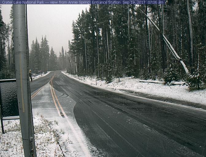
.The coolest air mass this season will move into the area tonight.
This along with clear skies and light winds will allow temperatures to fall to near or below freezing tonight into early Friday morning.

ORZ029>031-142300-
/O.UPG.KMFR.FZ.A.0006.170915T0900Z-170915T1500Z/
/O.NEW.KMFR.FZ.W.0011.170915T0900Z-170915T1500Z/
Klamath Basin- Northern and Eastern Klamath County and Western Lake County- Central and Eastern Lake County-
Including the cities of Beatty, Bly, Chemult, Crescent,
Gilchrist, and Sprague River 334 AM PDT Thu Sep 14 2017

...FREEZE WARNING IN EFFECT FROM 2 AM TO 8 AM PDT FRIDAY...

The National Weather Service in Medford has issued a Freeze
Warning...which is in effect from 2 AM to 8 AM PDT Friday. The
Freeze Watch is no longer in effect.

* Temperature...Mid to upper 20s with typically cooler spots
dropping into the lower 20s.

* Locations include...Chemult...Crescent...Silver Lake,
Chiloquin, Sprague River and Bly.

* Impacts...Sensitive vegetation may be killed if left
unprotected.

* View the hazard area in detail at
https://www.wrh.noaa.gov/mfr/HAZARD

Precautionary/preparedness actions...

A Freeze Warning means sub-freezing temperatures are imminent or highly likely. These conditions will kill crops and other sensitive vegetation.