
Fires continue to grow in the Modoc National Forest, largest at 19,000 acres
/Continuing fire weather expands fires and challenges firefighters
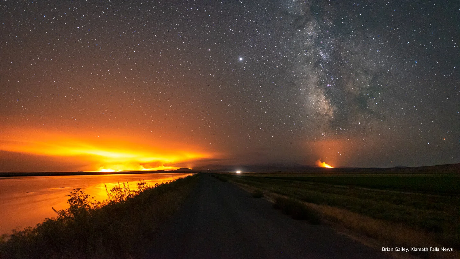
Looking south into the Lava Beds National Monument; The Caldwell Fire to the left and an unknown fire to the right. (Image: Brian Gailey)
MODOC NATIONAL FOREST, Calif. - There are now 15 active fires on the Modoc National Forest. California Interagency Incident Management Team 12 is taking over management of the July Complex this morning. The Gold Fire remains the largest in the national forest at 19,000 acres and has 35% containment.
July Complex
While most fires of the July Complex have been kept relatively small with swift and decisive containment efforts, five have now grown large.
Caldwell Fire, July 23, 2020 (Image: Inciweb)
The Dalton (T45N R8E Sec16) and Lone (T45N R8E Sec19) fires were very active yesterday growing to a combined 2,500-acre estimate. No evacuations are associated with these fires at this time. At last report, retardant lines were helping hold the eastern flank.
The Caldwell Fire (T45N R4E Sec35) was also active growing to 7,903 acres with the smoke plume visible for long distances. Wind-driven growth towards the west and south yesterday necessitated the closure of the Lava Beds National Monument and Forest Service roads in the area. It is not advisable to visit the Medicine Lake area.
The Allen Fire (T41N R8E Sec30) was last reported at 800 acres and holding along County Road 85.
The Canyon Fire (T41N R9E Sec16) is 234 acres and still 100-percent contained.
Fire officials are asking the public to stay away from the Medicine Lake Recreation area due to the unpredictability of the July Complex Fire that has resulted in the closure of Lava Beds National Monument. Presently Forest Roads 10 and 49 from the Park and County Road 97 off of Hwy 139 at Tionesta are closed.
Caldwell Fire, July 24, 2020 (Image: Brian Gailey)
Gold Fire
The Gold Fire is located south of Adin California along Highway 139. Intensity of the 19,000 acre fire dramatically increased from late yesterday afternoon until late evening and moderated overnight. So far the Gold Fire has destroyed 7 structures and injured 2 people.
Additional evacuation orders and warnings were issued (see below).
Today, crews will continue to construct and reinforce fire containment lines. The incident is burning in areas with private residences, ranches and commercial operations including agriculture, livestock and timber.
There are cultural resources that are threatened.
With continued active afternoon fire behavior, the upper Cal Pines area may be threatened in this time period. There is still a threat of fires from previous lightning strikes. The Damage Inspection Team will continue surveying the fire area today. All personnel attached to the incident will continue to implement COVID incident processes.
Evacuation Orders
Immediate threat to life. A lawful order to leave now, the area is closed to public access
Zone A - All residents along Hwy 139 from Susanville Rd. (A-2) south to Termo Grasshopper Rd.
Zone B - Areas south of Ash Valley Rd. west of Spooner Rd., east of Hwy 139, and north of Termo Grasshopper Rd.
Zone C - Areas west of Hwy 139, south of Haydenhill Rd., east of Anderson Ranch Rd/Dixie Valley Rd and north of Long Flat Road.
Zone G - Area north of Ash Valley Rd. to Rail Canyon north to the Modoc County line and west to Hwy 139.
Zone H-1 - Area north of Ash Valley Rd. at Knox Mountain north to the Modoc County Line and west to Rail Canyon.
Evacuation Warnings
Potential threat to life and property. Those who require additional time to evacuate or have pets/livestock should leave now
Zone D - Ash Valley Rd. at US-395 west to Spooner Rd., south on Spooner Rd. to Hwy 139 and east on Hwy 139 to Termo Grasshopper Rd. to US-395.
Zone E - Areas west of Hwy 139 from Termo Grasshopper Rd. south to Gleghorn Rd. and east of Slate Creek Rd.
Zone F - Area south Susanville Rd. (A-2) from Hwy 139 west to US Forest Service Rd. 54/McClelland Rd. and north of Hayden Hill Rd.
Zone H-2 - Area north of Ash Valley Rd. at US-395 north to the Modoc County Line and west to Knox Mountain.
Zone I – Cal Pines Upper Hill units 4 and 5, and all areas within the boundaries of the intersection of California Pines Blvd. (71) and Canyon Creek Rd. south to Alpine Rd. west Manzanita Mountain and east to Woodward Road.
A community meeting will be held at the Cal Pines Lodge (750 Shasta View Drive) in Alturas at 11:00 AM Friday, July 24, 2020. Representatives from the agencies managing the incident will provide an incident update and be available for questions.
Resources assigned to the Gold Fire include:
21 Fire Crews
1,312 Personnel
12 Helicopters
133 Engines
27 Dozers
17 Water Tenders

Klamath Falls News coverage of the 2020 Wildfire Season is brought to you by Ace Towing.
We are currently looking for additional sponsors for coverage of the 2020 Fire Season. Would your business like to sponsor Klamath Falls News / Cascade Firewatch coverage of the 2020 Wildfire Season? Visit klamathfallsnews.org/current-opportunities or send us a note at sales@klamathfallsnews for more information.